Krabi · working sheet · from Klong Muang

Paddling the mangroves

Every mangrove channel worth a morning within driving range of Klong Muang, ranked for a 7-year-old and a 9-year-old in the front seat. Ratings and coordinates are Google-verified, not remembered. The wet season is an argument for this, not against it — mangrove creeks are sheltered, flat, and unbothered by the swell that closes the islands.

Checked 8 Aug 2026 · car assumed · ~12 days left in Krabi

If you only read this

  1. Ao Thalane, one morning. The default. Real mangrove tunnels, karst walls, macaques, 45 minutes away. Book the morning half-day, never the sunset one.

  2. Klong Root, any afternoon, twice. 300฿ for a two-person kayak with no clock on it, 25 minutes from the door. Not mangrove — freshwater — but it's the one you'll repeat, and the kids can swim in it.

  3. Bor Thor, if you want the good day. Paddle through a limestone tunnel to 3,000-year-old handprints. Better than Ao Thalane and a full day at 1h15 each way. You realistically get this or Ao Thalane, not both.

The map

Every pin is a coordinate resolved through the Google Places API on 8 Aug 2026 — not read off a blog. Tap a pin for the basics; each card below carries its own Maps link to navigate to.

Mangrove paddle Freshwater paddle Look, don't paddle Home — Klong Muang

Distances below are straight-line, measured from the resolved coordinates. The drive times beside them are estimates off road distance and Krabi's geography — the bay means almost nothing is as close as it looks.

The places

Ordered by how likely you are to actually go. Everything here clears the 4.0★ / 15-review floor except where flagged — and around Ao Luek the whole area has thin review counts, which is weak signal rather than a red flag.

Kayakers on flat water beneath limestone cliffs at Ao Thalane
Kayaks under the karst wall — Ao Thalane · Wikimedia Commons
Dense mangrove roots at the water's edge, Ao Thalane
The mangrove channel itself — root tunnels at mid tide
Tandem kayaks paddling through a narrow mangrove channel
Tandems in the narrows — this is the width you'll be paddling
Limestone cliffs rising from calm water at Ao Thalane bay
The bay end, where the creek opens out
Kayakers beside a sheer cliff face at Ao Thalane
The canyon section — the bit the kids will remember
Mangrove-lined waterway with karst peaks behind
Mangrove and karst together — the whole pitch in one frame
Kayak on still water reflecting the cliffs
Flat water. This is why it works for a seven-year-old.

Ao Thalane

Mangrove 4.4★ (542) · pier 4.6★ (569) · Ao Thalane Kayak Krabi
From Klong Muang
10.8 km direct
drive ~35 km, ~45 min
Cost
~800–1,000฿ adult
child rate 4–11
Shape
Half day, guided
tandem kayaks
Coordinates
8.145314, 98.748276

The one everybody means when they say mangrove kayaking in Krabi, and it earns it: proper root tunnels that close over your head, limestone walls straight out of the water, a canyon section, crab-eating macaques and kingfishers if you go early. The water is flat enough that Yali can sit in front of an adult and be delighted rather than frightened, and Romi can genuinely paddle.

Kid fit: the strongest on the list. Water plus animals — two of the three reliable categories in one morning, no walking involved.

Book the morning, not the sunset. Every operator pushes a sunset trip and it is exactly wrong for Yali: mangrove channels at dusk are the worst mosquito window in Krabi. Also tide-dependent — the narrow creeks need water in them, so ask the operator which slot matches the tide that day rather than picking by convenience.
Clear green water of Klong Root canal under overhanging jungle
Klong Root — spring-fed and genuinely clear · Wikimedia Commons
Narrow jungle canal at Klong Root with submerged trees
The narrow stretch — submerged trees, visible fish
Open pool at Klong Root surrounded by dense green vegetation
The open pool at the end — where the swimming happens

Klong Root

Freshwater 4.6★ (2,721) · Google
From Klong Muang
7.6 km direct
drive ~18 km, ~25 min
Cost
300฿ per 2-person kayak
+ 50฿ entry per adult
Shape
Self-paddle, no clock
life jackets included
Coordinates
8.095713, 98.808547

Being straight with you: this is not mangrove. It's a spring-fed freshwater canal through jungle — the "Clear Water Canal" — so if the mangrove part is the point, it doesn't qualify. But on every other axis it's the best thing here. Roughly 350฿ total for the four of you, no guide, no booking, no schedule, twenty-five minutes from the house, and the water is clear enough to see fish and clean enough to swim in.

Kid fit: the one you'll go back to. Paddle, stop, swim, paddle back. No tour pacing, no minivan, no other family's timetable. And it's fresh water, not a chlorinated pool — which matters for Yali's skin.

Go on a weekday morning. 2,700 reviews is a lot for a small canal; it fills with Thai day-trippers at weekends and the narrow section becomes a queue. Sunday is a work day for you anyway — use it.
Tha Pring mangrove river winding between limestone hills
Tha Pring river, the Bor Thor put-in · Wikimedia Commons
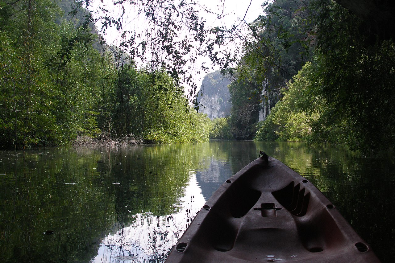
Mangrove-lined river channel under a limestone cliff
The channel narrowing toward the cave cliffs
Still mangrove water reflecting karst formations
Still water, no swell — the wet-season argument
Dense mangrove forest along the Tha Pring river bank
Mangrove wall along the bank
Limestone karst rising directly out of the mangrove river
Karst straight out of the water at Ao Luek
Wide bend in the Tha Pring mangrove river
The wide bend before the tunnel cave

Bor Thor — Tham Lot & the painted cave

Mangrove 4.5★ (37) · Tham Lot 5.0★ (2) · Tham Hua Kalok
From Klong Muang
37.5 km direct
drive ~65 km, ~1h15
Cost
~1,000–1,500฿ adult
half day, guided
Shape
Effectively a full day
with the drive
Coordinates
8.379602, 98.688136 (Tham Lot)
8.376611, 98.719282 (Tham Hua Kalok)

The better version of the same idea. You put in on the Tha Pring river, paddle mangrove channels, then go through a limestone tunnel cave with stalactites hanging into the water — and then reach Tham Phi Hua To, filed by Google as Tham Hua Kalok, where there are roughly 3,000-year-old handprints and figures painted on the wall. That last part is the difference: it turns a nice paddle into something Romi will still be describing in Goa.

Kid fit: the best day here on content, the worst on logistics. Water, a cave you paddle inside, and a genuinely astonishing thing to look at — but 2½ hours in the car total, which breaks the two-blocks-a-day rule on its own.

The tunnel cave is tide-gated. At high water there isn't headroom to pass, at very low water there isn't depth. Any operator worth using will already be scheduling around this — if one offers you a fixed daily time regardless of tide, that's the wrong operator. Also: Google has no clean record for a "Bor Thor pier"; the launch point exists only in operator listings. The pins above are the caves, not the put-in — confirm the meeting point when you book.
Streams and mangrove forest inside Than Bok Khorani National Park
The park's mangrove and stream system · Wikimedia Commons
Emerald pool fed by a spring in Than Bok Khorani National Park
The jade pools — swimmable, and free of chlorine
Shaded stream running through rainforest in the park
Shaded stream through the rainforest section
Waterfall and pool at Than Bok Khorani
Where the spring drops into the pool

Than Bok Khorani National Park

Mangrove 4.4★ (2,922) · Google
From Klong Muang
37.9 km direct
drive ~65 km, ~1h15
Cost
National park entry
foreigner rate applies
Shape
Pair it with Bor Thor
same district
Coordinates
8.388936, 98.735077

Not a separate trip — the same drive as Bor Thor, and the caves above sit inside its boundaries. What it adds is the land half: spring-fed jade pools you can swim in, a short rainforest walk, and shade. If you're already committing 2½ hours of driving, this is what makes the day worth it rather than a paddle bookended by a car.

Kid fit: the swimming is the draw. Natural pools rather than a hotel pool — the right kind of water for Yali.

Mosquitoes, seriously. Rainforest, standing water, and August. This is the single highest-exposure place on the sheet for Yali. Cover up before you get out of the car, not after the first bite, and don't linger past mid-afternoon.
Mangrove-lined estuary of the Krabi River
The Krabi River estuary Ko Klang sits in · Wikimedia Commons
Longtail boat moored among mangroves in the Krabi estuary
Longtails among the mangroves — how you get across
Wide mangrove channel in the Krabi River estuary at low tide
The channels at low tide — mudflat, not water
Mangrove forest edge along the Krabi River
Estuary mangrove — bigger, muddier, less photogenic than Ao Thalane
Boats and mangroves in the Krabi River estuary
Working water — this is a fishing community, not a resort strip

Ko Klang

Mangrove 4.6★ (27) · Google
From Klong Muang
19.8 km direct
drive ~30 km to town, then longtail
Cost
Longtail ~100฿/head
paddling arranged locally
Shape
Half day, unstructured
needs a phone call
Coordinates
8.040556, 98.937222

A Muslim fishing village on a mangrove island directly opposite Krabi Town, reached by longtail. Community-run tourism: batik workshops, boat-building, a homestay network, and mangrove paddling arranged through the village rather than a booking site. By the "place locals go" standard this is the most on-target thing on the sheet — and by every practical standard it's the hardest.

Kid fit: the batik workshop is a real hands-on hit — making and doing, both kids participating rather than one watching. The paddling is the weaker half here.

This one needs a phone call, not a click. There's no reliable online booking and the kayak provision is informal — you may turn up and find no boats free. Treat it as a village day with paddling as a maybe, and check tide: the estuary channels are mudflats at low water.
The twin limestone peaks of Khao Khanab Nam flanking the Krabi River
Khao Khanab Nam — the twin peaks over the river · Wikimedia Commons
Longtail boats beneath the Khao Khanab Nam cliffs
Longtails at the base of the cliffs
Raised wooden boardwalk through mangrove forest in Krabi
The mangrove boardwalk — walk it, don't paddle it
The Krabi River with mangroves and karst hills
The river between town and the peaks
Cave interior at Khao Khanab Nam
Inside the cave at the base of the peak

Khao Khanab Nam & the mangrove boardwalk

Look, don't paddle 4.5★ (635) · Khao Khanab Nam boardwalk — rating unverified
From Klong Muang
18.2 km direct
drive ~30 km, ~35 min
Cost
Longtail ~400฿/boat
boardwalk free
Shape
90 minutes
bolt onto a town errand
Coordinates
8.077401, 98.920637 (peaks)
8.078649, 98.920010 (boardwalk)

Included for honesty rather than enthusiasm: this is the mangrove you walk through, on a raised boardwalk out of Krabi Town, plus a longtail ride to the twin limestone peaks in the river. No kayaking. But it's the cheapest way to show the kids what a mangrove actually is — mudskippers, fiddler crabs, the root architecture at eye level — and it costs nothing on a day you're in town anyway.

Kid fit: decent as a bolt-on, thin as a destination. Fiddler crabs do a lot of work here.

Google has no rating for the boardwalk — the only matching record is the provincial mangrove management office. Treat the walkway as unverified: it exists and is well documented, but no review signal backs it.
The enclosed lagoon at Ko Hong ringed by limestone walls
The lagoon — the "room" the island is named for · Wikimedia Commons
Turquoise water and white sand beach at Ko Hong
The beach — genuinely as good as the pictures
Limestone cliffs rising from the sea at Ko Hong
Open water on the approach — the August problem
Narrow entrance channel into the Ko Hong lagoon
The entrance channel into the lagoon

Ko Hong

Look, don't paddle 4.6★ (519) · Google
From Klong Muang
9.4 km direct
but boat-only access
Cost
~1,200–1,800฿ adult
speedboat day trip
Shape
Full day tour
not a self-drive option
Coordinates
8.078091, 98.678281

On the map it looks like the nearest thing here — 9 km, straight out from the beach. It isn't: access is by open-sea speedboat, and the lagoon is a marine-park island rather than a mangrove. Listed so you can rule it out deliberately rather than keep rediscovering it. Beautiful, and the wrong month.

Kid fit: unknown, because the sea decides. A bouncy 40-minute speedboat crossing with two kids in August is a different trip from the calm-season version.

August is the reason to skip it. Open-water crossings in the southwest monsoon get cancelled, rescheduled, or run anyway in conditions you'd rather not have paid for. The mangroves above have no such problem — that's the whole argument of this sheet.
Longtail boats on a shallow mangrove-fringed shore in Krabi
Longtails on a shallow Krabi shore · Wikimedia Commons
Tidal flats and mangroves on the Krabi coast
Tidal flat — what Ao Nam Mao looks like for much of the day

Ao Nam Mao

Look, don't paddle 4.3★ (1,884) · Google
From Klong Muang
11.7 km direct
drive ~28 km, ~40 min
Cost
Free to visit
Shape
Transit point
not a destination
Coordinates
8.029563, 98.862656

Comes up in every kayaking search and shouldn't. It's a pier and a broad tidal flat — mostly where you catch a longtail to Railay. Some operators list mangrove paddling here; the mangrove is thin and the shore goes out a very long way at low tide. Skip it for kayaking, and remember it only as the Railay crossing.

Kid fit: poor. Mud, not water, for most of the tidal cycle.

Before you book

Four things that decide whether the morning works, none of which appear on a tour listing.

Tide is the whole thing

Every mangrove channel here is tidal. Too low and you're dragging a kayak across mud; too high and the root tunnels — the entire point — are underwater with no headroom. Bor Thor's tunnel cave is the strictest: it physically closes at high water.

Ask any operator which tide their slot is built around. A good one answers immediately. One that offers you the same two departure times every day of the month is selling a minivan ride.

Mosquitoes — the Yali constraint

Mangrove + standing water + August is the worst combination on this trip, and it's a hard filter rather than background information.

  • No sunset trips. Dusk in a mangrove channel is the peak bite window. Every operator markets one; decline it.
  • Morning slots only — roughly 8–12.
  • Long sleeves and repellent before getting in the boat.
  • Than Bok Khorani's rainforest section is the highest-exposure spot on the sheet.

What this actually costs

Ao Thalane, four of you, guided half day: roughly 2,800–3,400฿ with the child rate. That's a real number against the monthly ceiling.

Klong Root, four of you, self-paddle: two kayaks at 300฿ plus two adult entries at 50฿ — about 700฿, and you can go three times for less than one guided trip.

Doing one guided day and repeating Klong Root is the shape that fits the budget without anyone feeling short-changed.

The split, said out loud

Ao Thalane is Mor's — the proper day out, the guide, the thing you'd tell people about.

Klong Root is Yonatan's — 700฿, no booking, no schedule, a canal with almost no infrastructure on it.

They're two weeks apart in effort and four days apart in the calendar. Do both, and the argument doesn't need having.